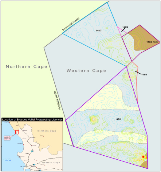
Radiometric contours generated from fieldwork, using a scintilometer in combination with a GPS. The contours are displayed using graduated colors and indicate areas for further exploration and/or soil sampling.