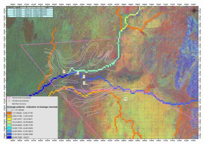
Drainage patterns were extracted from
a DEM for this project. The drainage patterns, together with spectral
analysis of a LandSat image, were used to confine exploration targets.
Ancillary data, in this case historical borehole data, was incorporated
to aid in the analysis.