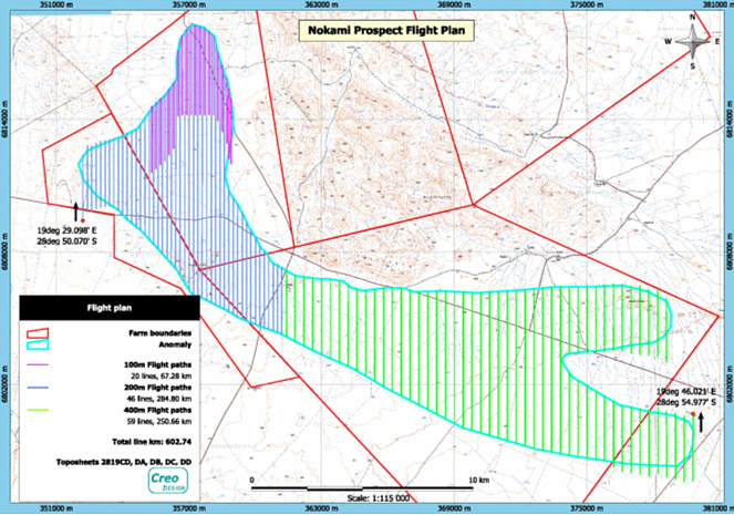
Preparation for Electro-Magnetic (EM)
surveying of an area: flight paths were generated to show higher and lower
priority areas to the helicopter pilot. This exercise was also done to
find the optimal distribution of line kilometers that was still within
the project budget.