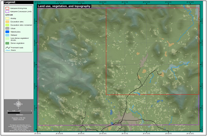
Landuse/landcover classified from Ikonos
image. A high resolution Ikonos image (1m) for a concession was classified
into 8 relevant classes, which in turn, was used during a fieldwork exercise.
Local infrastructure could be obtained from the image, as well as natural
phenomena.